Careers
Locations
BidDocs
Contact Us
WHO WE ARE
About Us
Our Achievements
Our History
Team Ardurra
WHAT WE DO
Markets
Water / Wastewater
Transportation
Public Works
Environmental
Aviation
Civil
Aquatics
Emergency Management
Transit
Services
Surveying
Structural
Community Relations
Landscape Architecture
Geospatial
PROJECTS
NEWS
ESG
CAREERS
LOCATIONS
BIDDOCS
CONTACT US
OUR PROJECTS
Filter By Topic
All
Water / Wastewater
Transportation
Transit
Surveying
Structural
Public Works
Landscape Architecture
Geospatial
Funding
Environmental
Emergency Management
Community Relations
Civil
Award
Aviation
Aquatics
Tag :- Geospatial
Geospatial
Westwinds Road Extension and Land Use Study
Geospatial
Texas Water Dev. Board-Asset Management Program for Small Systems
Geospatial
Gallatin County Land Use Profile and FLUM
Geospatial
Greer Strategic Asset Management Program
Water / Wastewater
,
Geospatial
North Carolina Statewide Lead Service Line Inventory
Geospatial
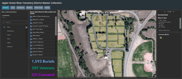
Upper Green River Cemetry District
Geospatial
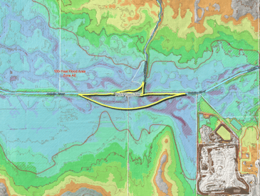
Stevens County Floodplains Design
Geospatial
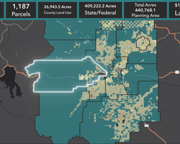
Park County Land Use Plan
Geospatial
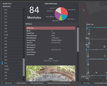
COE Sewer System Inventory
Prev
1
2
Next
Contact
Us
Partner with us today to change how tomorrow looks. Make it happen.
CONTACT US